
Nationwide Site Plans & Permit Drawing Services
Residential · Commercial · ContractorsQuestions? Email us ↗
Subdivision Platting & Site Layouts • All 50 States

Approval-Ready Subdivision Plats Without the Delay

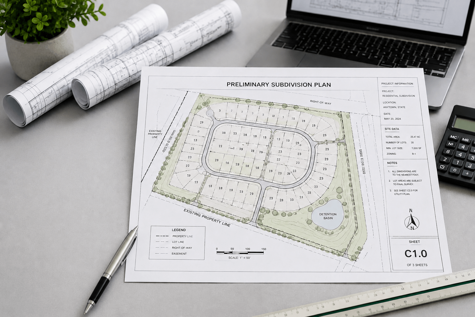
Send us your property details and parcel maps. We engineer precise, municipality-compliant subdivision plats that map out exact lot boundaries, right-of-ways, utility easements, and setback requirements optimized for a fast planning commission review.

Free quote • No commitment required • Landowners, builders, and developers welcome

2d6d9c85 D196 4bd5 92cc 895cc116e9aa
Nationwide

Remote drawing support

Scoped

Project-specific deliverables

PDF

Digital drawing files

Confirmed

Timing after scope review

What your subdivision layouts project needs

The concern to resolve

How many lots may be feasible, and what access, easement, utility and approval steps affect the layout?

Drawing deliverables

Concept layout can show proposed lots and roads. Recorded plats, boundary certification, civil engineering and authority approvals require licensed professionals and a separately defined scope.

What to send us

Boundary and topographic survey, zoning details, acreage, utilities, access and planning comments.

Get a project-specific scope and price →

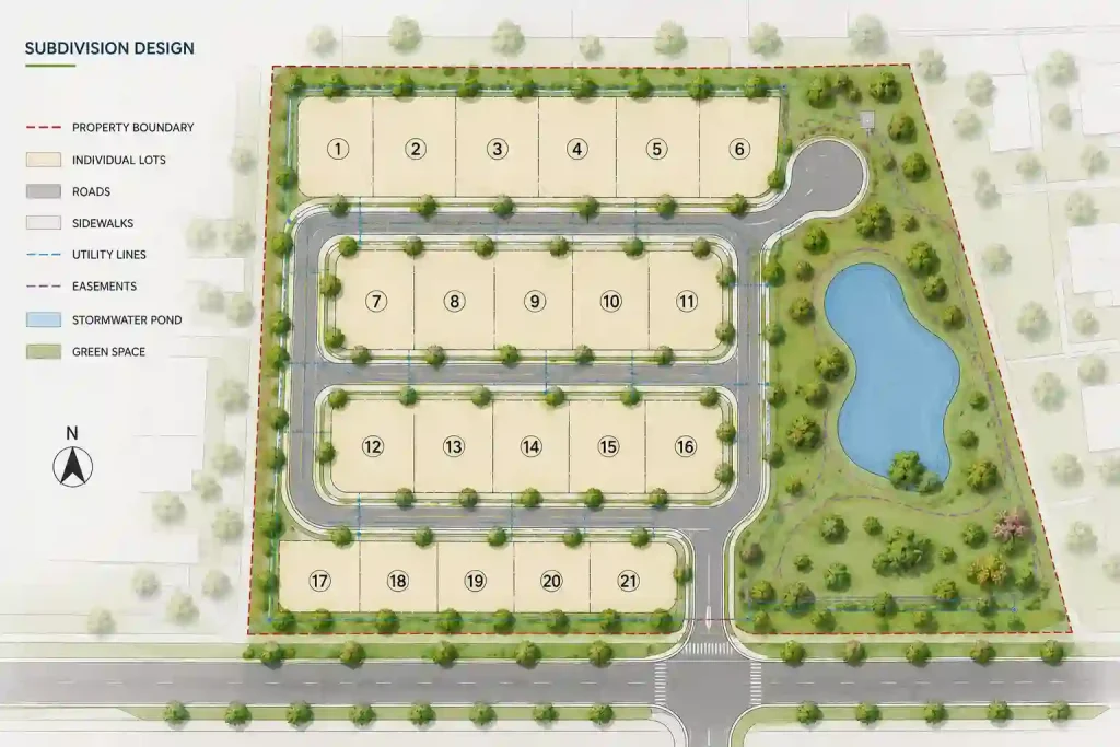
Subdivision Design Site Plan – Essential Components
Illustrative subdivision design visual; the exact drawings depend on your project and local review requirements.
What planning commissions require

A Precise Plat Makes Your Development Layout Easy to Verify

A professional subdivision plat gives the planning reviewer the land-use context that standard surveys do not. It clearly shows how your proposed lot splits or developments relate to existing topography, infrastructure, and whether the project respects all local zoning setbacks and land constraints.

Common subdivision plat details

01

Share Your Project Data

Submit your property address, existing land surveys, development goals, and any specific planning commission requirements or feedback.

02

Technical Land Analysis

Our team evaluates your property’s topography, zoning constraints, and land layout to determine the exact technical specifications required for your subdivision plat.

03

Engineering & Design Review

Your plat is engineered with precise lot boundaries, utility easements, and dimensions, then delivered to you for final review and confirmation.

04

Final Certified Delivery

Receive your completed, professional plat formatted for planning commission submission, council review, or future resubmission needs.

New Subdivision Plat

Shows the proposed lot boundaries, dimensions, placement, and relationship to existing site features.

Lot Split & Boundary

Useful for dividing large parcels into smaller lots, including setback, access, and easement considerations.

Infrastructure Layout

Documents how the proposed development integrates with existing utility lines, drainage, and municipal infrastructure.

Development Footprint

Outlines modifications to land usage, including changes in total size, zoning alignment, and necessary site adjustments.

Land Re-zoning

Clarifies whether the new development follows existing zoning bylaws or introduces a revised usage plan.

Easements & Access

Shows specific access points, right-of-way areas, and easements that affect total land usage.

Planning Correction

Updates missing labels, setback data, or boundary details identified by the planning commission reviewer.

Final Plat Approval

Finalizes the plat updates to meet all municipal codes and addresses specific reviewer feedback for final approval.

Question

Subdivision Plat

 Engineering/Development Plans

Primary purpose

Shows land parcel boundaries and subdivision layout.

Shows how the site infrastructure and improvements are engineered.

Typical details

Property lines, setbacks, lot dimensions, easements, and road access.

Grading, drainage, utility connections, paving, and structural details.

Review path

Zoning, planning commission, and land-use compliance review.

Civil engineering, stormwater, and infrastructure code compliance review.

What to send us

Address, property survey or legal description, and proposed lot layout.

Topographic data, utility information, project specifications, and local code requirements.

Transparent Subdivision Pricing

Flat-Rate Subdivision Plats. No
hidden fees.

Reviewer-requested revisions are supported within the original agreed scope. Final permit approval is determined by the reviewing authority, and refunds follow the published cancellation and refund policy.

Basic Subdivision Plan

Small lots/Simple splits

Custom Quote

per plan · timing confirmed by project scope

Advanced Subdivision Plan

Multi-lot/Complex layouts

MOST POPULAR

Custom Quote

per plan · timing confirmed by project scope

Enterprise Development Plan

Large scale/Full site plans

Custom Quote

per plan · timing confirmed by project scope

Subdivision and lot-split concept drafting is custom quoted. Licensed survey, legal descriptions, and professional engineering are separate unless specifically coordinated.

Deliverable

Concept: Custom Quote

Detailed: Custom Quote

Correction

Property boundaries & existing structures

Included

Included

As needed

Proposed subdivision footprint

Included

Included

Updated

Zoning setback labels

Basic

Expanded

Corrected

Infrastructure & access points

Optional

Included

As required

Easement references

Where available

Included where available

Corrected

Reviewer comment response

Not included

Not included

Included

Delivery format

Submission-ready PDF

Detailed submission-ready PDF

Resubmission-ready PDF

1. Property address

The address allows us to analyze the parcel context, zoning regulations, and understand the specific jurisdiction requirements involved.

2. Development Specifications

Share the proposed lot size, boundary adjustments, infrastructure needs, and the type of subdivision or land-use plan required.

3. Supporting Documents

Upload any existing surveys, plat maps, topographical sketches, prior planning documents, or commission feedback if available.

4. Custom Instructions

Include any special site constraints, municipal requirements, or specific design preferences to ensure the final plat meets all local standards.

Subdivision Planning Questions

Everything You Need to Know Before You Start

Local requirements differ, so confirm final submission requirements with your city or county planning department.

It is a scaled property drawing showing the proposed lot boundaries, subdivision layout, road access, setbacks, utility easements, and other relevant site features required by the planning commission.

Yes, most local jurisdictions require a formal subdivision plat approval to ensure compliance with zoning, density, and infrastructure standards before development can proceed.

Typically, you will need a current property survey, legal description, topographical data, and specific site plans that meet municipal submission guidelines.

Yes, we specialize in revising plats to address specific reviewer comments, including missing labels, setback corrections, or boundary adjustments required for final approval.

We offer fast turnaround times, with standard subdivision plats typically delivered within 24 hours.

Subdivision and lot-split drafting is custom quoted. Licensed survey, legal descriptions, and professional engineering are separate unless specifically coordinated for the project.

Ready to move forward?

Get the right subdivision plat for your development path

Send your project details. We will review the scope and reply with the recommended drawing package, price, and expected turnaround.

Request your free subdivision plat quote

No payment is required. Include as much information as you currently have.