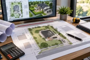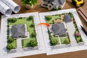
A building department reviews a site plan to verify property boundaries, zoning setbacks, building placement, lot coverage, access, and other details that affect permit compliance. Reviewers also check whether the drawing clearly identifies existing structures, proposed improvements, and relevant site restrictions. Their goal is to understand the proposed work and determine whether it meets applicable local requirements.
At Permit For Site Plan, we help homeowners, contractors, and property owners prepare drawings that communicate these details clearly. Understanding what reviewers look for can help you identify missing information, prepare a more complete application, and reduce avoidable correction requests.
Building Department Site Plan Review: What Officials Verify
Building departments do more than check whether a drawing looks professional. They evaluate how the proposed construction fits within the property and whether the information supports a decision under applicable zoning and building regulations.
When reviewing a site plan, officials typically consider three questions: Does the drawing accurately represent the property? Does the proposed construction comply with relevant placement restrictions? And does the plan provide enough information to evaluate the project?
Our building permit site plan services help applicants present the information reviewers commonly need, including property layouts, building footprints, dimensions, and proposed improvements.
Requirements vary between municipalities and project types. A residential deck may require a straightforward property drawing, while a commercial project may need additional engineering, drainage, parking, or access information.
Property Identification and Boundary Information
Reviewers first need to identify the property and understand its physical boundaries. Without reliable property information, they cannot confidently evaluate where proposed construction will occur.
A typical drawing identifies the project address, property lines, lot dimensions, and the location of existing improvements. Some jurisdictions also request parcel identification, boundary bearings, or a legal description.

Accurate boundaries matter because setbacks and building placement depend on the property’s actual limits. A drawing based on incorrect lot dimensions can create problems even when the proposed structure appears properly positioned.
When preparing a site plan for permit, we use available property information to organize the existing layout and proposed work. Where the project requires a boundary survey or other professional verification, applicants should obtain that information rather than rely on approximate measurements.
Existing Structures and Proposed Construction
One important question is whether the reviewer can distinguish what already exists from what the applicant intends to build.
The drawing should identify relevant existing buildings, driveways, patios, decks, and other improvements. It should also clearly show proposed additions, new structures, or changes to existing features.
For example, a homeowner adding a detached garage should show both the existing house and the proposed garage. This allows reviewers to evaluate the new structure’s location relative to property boundaries, other buildings, and access areas.
We recommend consistent labels and line styles to distinguish existing construction from proposed work. If the project involves demolition, the drawing should identify the features scheduled for removal rather than simply omit them.
Clear distinctions help prevent confusion about the project’s scope and the property’s final configuration.
Setbacks and Zoning Placement Requirements
Setbacks establish required distances between buildings or other improvements and property boundaries. Building departments review these measurements to determine whether proposed construction meets applicable zoning restrictions.
For example, a proposed garage may need to maintain specific distances from the side and rear property lines. The required distances depend on the local zoning district, structure type, and other applicable regulations.
Reviewers commonly examine:
- Front, side, and rear setback distances for proposed construction.
- Building placement relative to property boundaries and existing structures.
- Applicable zoning restrictions, including special setbacks or building separation requirements.
We recommend reviewing how to measure permit setback requirements before finalizing a drawing. Clear dimensions help reviewers verify compliance without estimating distances from the plan.
A scaled drawing supports accurate presentation, but it cannot compensate for incorrect property measurements or missing zoning information.
Lot Coverage and Impervious Surface Calculations
Lot coverage helps reviewers determine how much of a property contains buildings or other improvements subject to local coverage limits. Some jurisdictions also regulate impervious surfaces, which may include roofs, paved driveways, patios, and other surfaces that restrict water infiltration.
These calculations are related but not necessarily identical. Local ordinances determine which improvements count toward each limit.
For example, a homeowner planning a garage and expanded driveway may need to demonstrate that the completed project remains within applicable lot coverage or impervious area limits.
Our guide to lot coverage calculation explains how property areas and improvements relate to these requirements.
When calculations apply, reviewers may compare existing coverage with the proposed total. Clearly identifying the area of each relevant improvement makes this comparison easier and helps prevent inconsistencies between the drawing and application documents.
Driveway Access, Parking, and Site Circulation
Building departments may also review how people and vehicles enter, leave, and move through the property.
For residential projects, this can involve driveway placement, access to a new garage, or changes to existing parking areas. Commercial projects may require more detailed parking layouts, vehicle circulation, loading access, or accessibility information.
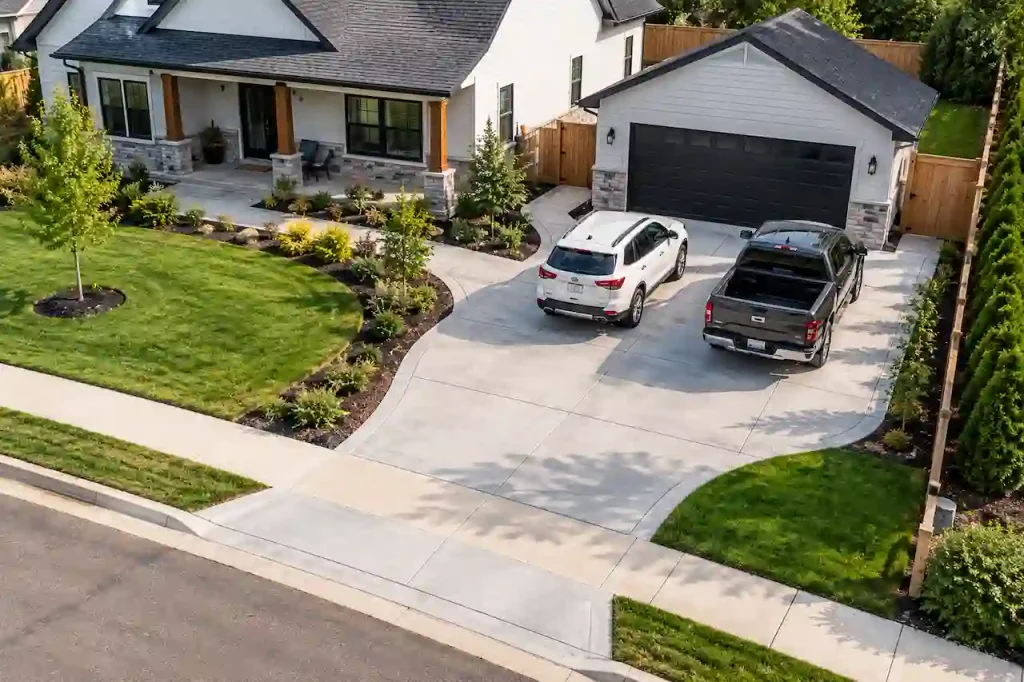
A site plan should communicate the relevant driveway locations, dimensions, and relationships to streets and proposed structures. When a project changes existing access, the drawing should distinguish the current arrangement from the proposed layout.
For example, a garage addition that changes the driveway alignment may affect access or other site improvements. Reviewers need enough information to understand those changes and assess applicable requirements.
Easements and Rights-of-Way
Easements and rights-of-way can restrict where property owners place structures or make improvements. These areas may provide access for utilities, drainage systems, neighboring properties, or public infrastructure.
Reviewers may check whether proposed construction overlaps a recorded easement or interferes with an area subject to specific restrictions.
A property owner might have enough physical space for a new shed but still face limitations because a utility easement crosses the intended construction area.
Our guide to understanding easements on a site plan explains why these restrictions matter during permit preparation.
We recommend identifying relevant easements using reliable property documents. If an easement’s location or permitted uses are uncertain, applicants may need additional verification before finalizing the proposed building placement.
Utilities and Drainage Requirements
Some projects require information about water service, sewer connections, septic systems, electrical infrastructure, or site drainage. The necessary details depend on the construction scope and local review procedures.
For example, a detached garage with no plumbing may have different utility documentation requirements than a new residence or commercial building.
Projects that change grading or increase paved areas may also require drainage information. Reviewers may need to understand how the proposed work affects runoff, slopes, and nearby properties.
A site plan can identify relevant utility locations and drainage features, but certain projects require separate engineering drawings or professional evaluations.
We help organize site information within the drawing scope and recommend confirming additional technical requirements with the appropriate department before submission.
Site Plan Scale, North Arrow, and Drawing Labels
Even when a drawing contains accurate property information, poor presentation can make it difficult to review. Building departments need to interpret measurements, locations, and proposed improvements without confusion.
A clear site plan generally includes an appropriate drawing scale, north arrow, project identification, readable dimensions, and labels explaining important property features.
We recommend choosing a scale that keeps the drawing legible at the required sheet size. Applicants should also check printed or exported PDFs because automatic resizing can affect measurements taken directly from the page.
Our guide on how to read a site plan explains how common drawing elements help readers interpret a property layout.
Consistent line styles and labels also help reviewers distinguish existing conditions, proposed work, and any structures scheduled for removal.
Consistency With Floor Plans and Elevations
A site plan is often one part of a larger permit drawing package. Reviewers may compare it with floor plans, elevations, and other supporting documents to confirm that the proposed construction matches across the application.
For example, if the site plan shows a 20-foot-wide addition but the floor plan identifies a different width, the reviewer may request clarification.
Building footprints, project descriptions, dimensions, and other shared information should remain consistent. Where different drawings show different aspects of the project, their measurements and labels should still agree.
Our drafting services can help applicants organize drawing updates and maintain consistency when revising permit documents.
A coordinated drawing set makes the construction scope easier to understand and reduces avoidable discrepancies during review.
Common Building Department Site Plan Corrections
When applicants ask what does a building department look for on a site plan, they often want to know which problems might delay their permit.
Correction requests commonly arise when drawings lack information that reviewers need to evaluate the proposed work.
Typical issues include:
- Missing property boundaries, setbacks, or proposed structure dimensions.
- Unclear distinctions between existing buildings and new construction.
- Incorrect lot coverage information or unidentified easements.
- Missing driveway, access, or drainage details when required.
- Conflicting measurements between site plans and other drawings.
- Unreadable labels, incorrect scales, or incomplete project information.
Our article on common permit submission mistakes explains how applicants can identify and avoid frequent documentation problems.
Permit For SitePlan
+1
A correction notice does not necessarily mean the department has permanently rejected the project. Reviewers may simply need additional information or revised drawings before continuing.
If you’ve already received comments, our permit correction and plan revision services can help address drawing-related issues. We recommend reviewing every comment carefully and updating all affected sheets before resubmitting.
Building Department Site Plan Review Checklist
Before submitting your application, review the drawing against your municipality’s official checklist. A final check can help identify missing dimensions, inconsistent information, or unclear proposed improvements.
| Review area | What to verify |
|---|---|
| Property identification | Correct address, parcel details, and boundaries |
| Existing conditions | Relevant structures and improvements appear accurately |
| Proposed work | New construction is clearly identified and dimensioned |
| Setbacks | Required distances are shown and checked against local rules |
| Lot coverage | Calculations use the applicable zoning definitions |
| Access and parking | Driveways and parking details meet project requirements |
| Easements | Relevant property restrictions appear on the drawing |
| Utilities and drainage | Required site-specific information is included |
| Drawing clarity | Scale, north arrow, dimensions, and labels are readable |
| Drawing consistency | Site plans agree with supporting permit documents |
We recommend completing this review before uploading the final drawing package. If a requirement is unclear, contact the building or planning department rather than assuming a generic site plan checklist applies.
Get Your Site Plan Reviewed for Drawing Requirements
Understanding what a building department looks for on a site plan helps you prepare clearer drawings and identify potential documentation issues before submission. Accurate property information, properly labeled improvements, relevant zoning measurements, and consistent drawing details all support a more efficient review process.
At Permit For Site Plan, we help homeowners and contractors prepare and revise site plans according to their project scope and available jurisdiction instructions.
Have a municipal site plan checklist or correction notice? Send us the requirements, your existing drawing if available, and a description of the proposed work. You can request a custom quote so we can review the drawing scope and explain the drafting assistance your project may need.
Frequently Asked Questions
What is the first thing a building department checks on a site plan?
Reviewers typically begin by identifying the property, understanding the proposed construction, and checking whether the drawing includes enough information for review. The exact sequence varies by department.
Does every building permit require a site plan?
No. Site plan requirements depend on the project and jurisdiction. Exterior additions and new structures commonly require property layout information, while some interior-only projects may not need a site plan.
Can a building department reject a site plan because of missing setbacks?
Yes. If reviewers cannot verify required setbacks, they may request additional dimensions or a revised drawing. A proposed structure that violates applicable setback rules may require redesign or another authorized approval process.
Do building departments require a property survey?
Not always. Some departments accept drawings prepared from reliable property information for certain projects, while others require a current survey or professional boundary verification. Check the municipality’s instructions.
Does a site plan need to show neighboring buildings?
Some jurisdictions require neighboring structures or additional surrounding-property information, particularly where building separation, fire access, or other site conditions matter. Many straightforward residential applications do not require the same level of detail.
Who reviews a site plan for a building permit?
Depending on the jurisdiction and project, planning, zoning, building, engineering, fire, or other departments may review relevant portions of the application.
Can I revise a site plan after receiving correction comments?
Yes. Many departments allow applicants to submit revised drawings through their established correction process. Follow the reviewer’s instructions and update related documents when changes affect multiple sheets.
Does a professionally drafted site plan guarantee permit approval?
No. Professional drafting can improve drawing clarity and organization, but the reviewing authority determines whether the project meets applicable requirements and whether the submission is complete.