Every successful residential development starts with accurate subdivision design plans. Whether you are dividing land into two lots or planning a large residential community, your drawings form the foundation of the entire approval process. Well-prepared plans help planning departments review your proposal efficiently, reduce costly revisions, and keep your development on schedule.
Subdivision projects involve much more than creating lot lines. Developers must evaluate zoning regulations, environmental restrictions, utility availability, roadway design, stormwater management, and local subdivision ordinances before construction begins. Missing even one requirement can delay approvals, increase engineering costs, or require major redesigns.
Table of Contents
- 1. What Are Subdivision Design Plans?
- 2. Why Subdivision Planning Matters
- 3. Pre-Development Due Diligence
- 4. Complete Subdivision Drawing Package
- 5. The Subdivision Approval Process
- 6. Infrastructure Requirements
- 7. Practical Permit Review Checklist
- 8. Preparing Your Project Information
- 9. Common Mistakes Developers Make
- 10. Why Work With Permit For SitePlan?
- 11. Frequently Asked Questions
What Are Subdivision Design Plans?
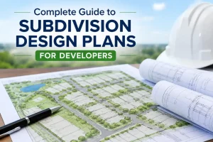
Subdivision design plans are detailed engineering and planning documents used to divide a parcel of land into multiple legal lots for residential, commercial, or mixed-use development. These plans illustrate property boundaries, proposed lot layouts, streets, utility systems, drainage, easements, open spaces, and other improvements required by local planning authorities.
Planning departments use subdivision design plans to verify that every proposed lot complies with zoning regulations, access requirements, utility standards, environmental regulations, and public safety requirements before granting development approval.
Depending on the project size and local jurisdiction, subdivision plans may be reviewed by multiple agencies, including planning departments, engineering divisions, utility providers, environmental agencies, transportation departments, and fire authorities.
Why Subdivision Planning Matters
Why Subdivision Planning Matters
Proper subdivision planning reduces development risks and helps projects move smoothly through the approval process. Investing time in accurate planning early often prevents expensive delays later. Early planning creates a stronger foundation for a successful development while lowering overall project costs.
Well-prepared subdivision design plans help developers:
- Speed up permit approvals
- Minimize review comments
- Reduce engineering revisions
- Ensure zoning compliance
- Protect environmental resources
- Coordinate utility installation
- Improve project budgeting
- Increase investor confidence
- Simplify future lot sales and construction
Pre-Development Due Diligence
Before preparing subdivision design plans, developers should perform detailed due diligence to determine whether the project is financially and technically feasible. Early research identifies potential obstacles before engineering work begins, reducing costly redesigns later.
A complete due diligence review should include:
Verify Zoning Compliance
Confirm that the property’s zoning designation allows subdivision and residential development. Review minimum lot sizes, frontage requirements, density limitations, building setbacks, height restrictions, and allowable land uses.
Review Existing Property Records
Obtain surveys, title reports, easement documents, recorded plats, deed restrictions, and utility maps. These records help identify legal limitations that may affect lot layout.
Evaluate Utility Availability
Determine whether sufficient water, sewer, electric, gas, and telecommunications services are available for the proposed development. Utility upgrades can significantly affect project costs.
Assess Environmental Constraints
Investigate wetlands, protected habitats, floodplains, steep slopes, tree preservation requirements, endangered species, and environmental regulations that could restrict development.
Analyze Access Requirements
Verify legal road access, traffic requirements, emergency vehicle access, and connectivity to surrounding transportation networks.
Understand Development Costs
Estimate impact fees, utility connection charges, engineering costs, permit fees, infrastructure construction expenses, and long-term maintenance obligations before finalizing project budgets.
Coordinate With Local Agencies
Early meetings with planning officials, engineers, utility providers, and public works departments often identify potential issues before formal applications are submitted. Proper due diligence creates a stronger foundation for successful subdivision permit approvals while reducing expensive surprises later in the project.
Complete Subdivision Design Plans Drawing Package

A professional subdivision design plans package includes multiple technical drawings prepared by surveyors, engineers, planners, and drafting specialists. Each drawing supports a different part of the review process.
Typical permit drawing packages include:
Existing Conditions Plan
Documents current site conditions, including property boundaries, topography, utilities, structures, vegetation, drainage features, easements, and neighboring developments.
Preliminary Plat
Shows the proposed subdivision layout, including new lot lines, lot numbers, street alignments, open spaces, sidewalks, easements, and preliminary dimensions. Planning commissions typically review this document first.
Grading Plan
Illustrates proposed elevations, earthwork, drainage patterns, retaining walls, and slope stabilization to ensure safe site development.
Utility Plan
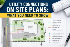
Identifies water mains, sanitary sewer systems, storm drainage networks, fire hydrants, utility easements, and service connections for each proposed lot.
Street Plans and Profiles
Provide detailed roadway layouts, centerlines, pavement widths, intersections, sidewalks, curb ramps, vertical profiles, and construction specifications.
Stormwater Management Plan
Demonstrates how runoff will be collected, stored, treated, and discharged while meeting local environmental regulations.
Landscape Plan
Shows required street trees, buffer zones, common areas, open spaces, planting schedules, irrigation systems, and environmental preservation measures.
Erosion and Sediment Control Plan
Many jurisdictions require temporary erosion control measures during construction to prevent sediment from entering nearby waterways.
Final Plat
After all conditions have been satisfied, the final plat becomes the legally recorded document establishing individual property lots, easements, road dedications, and ownership boundaries. A complete permit drawing package improves review efficiency and helps planning departments evaluate every aspect of the proposed subdivision with fewer revision requests.
The Subdivision Approval Process
Obtaining approval for subdivision design plans involves several review stages before lots can be legally created and sold. Although every city or county follows its own procedures, most jurisdictions require developers to complete a formal entitlement process that ensures the proposed subdivision complies with zoning regulations, engineering standards, environmental requirements, and public safety codes.
Understanding each step allows developers to prepare complete applications, respond quickly to review comments, and reduce unnecessary project delays.
1. Pre-Application Meeting
Most planning departments encourage developers to schedule a pre-application meeting before submitting subdivision design plans. During this meeting, planners review the project concept, identify potential concerns, explain submission requirements, and clarify applicable zoning regulations.
2. Prepare and Submit Preliminary Plans
After completing due diligence, developers prepare the preliminary subdivision drawing package. Submitting complete documentation significantly improves review efficiency. A complete submission usually includes:
- Preliminary plat
- Existing conditions plan
- Utility layout
- Grading plan
- Stormwater management plan
- Traffic study (if required)
- Environmental reports
- Drainage calculations
- Application forms
- Required review fees
3. Department Review
Following submission, multiple agencies evaluate the subdivision simultaneously. Each department reviews the plans for compliance with applicable regulations and provides comments requiring clarification or revisions. Depending on the municipality, reviewers may include:
- Planning Department
- Engineering Division
- Public Works
- Transportation Department
- Water Authority
- Sewer Authority
- Fire Department
- Environmental Agency
- Utility Providers
4. Public Notification
Many subdivisions require public notification before approval. This process allows nearby property owners to provide comments or express concerns before final approval. Depending on local regulations, this may include:
- Mailing notices to neighboring property owners
- Publishing legal notices
- Posting signs on the project site
- Scheduling public hearings
5. Planning Commission Review
Planning commissions review the proposed subdivision during a public meeting.
Commission members evaluate:
- Consistency with the comprehensive plan
- Neighborhood compatibility
- Traffic impacts
- Environmental protection
- Utility capacity
- Public infrastructure
- Community concerns
6. Complete Required Revisions
Most subdivision approvals include conditions that developers must satisfy before final approval. Promptly addressing review comments helps maintain project schedules.
Common conditions include:
- Revising lot layouts
- Updating utility plans
- Increasing drainage capacity
- Adding sidewalks
- Adjusting landscaping
- Modifying roadway widths
- Completing additional engineering studies
7. Final Plat Approval and Recording
Once all conditions have been satisfied, the final plat is submitted for review. After approval, the plat is recorded with the county recorder or registrar, legally creating the individual lots.
Only after recording can developers typically:
- Sell lots
- Transfer ownership
- Obtain building permits
- Begin vertical construction
Typical Timeline for Subdivision Design Plans
Although every jurisdiction is different, developers should expect subdivision approvals to take several months. Large developments, environmentally sensitive sites, or projects requiring public hearings may take considerably longer.
| Project Stage | Typical Timeline |
| Due diligence | 2–6 weeks |
| Survey & existing conditions | 2–4 weeks |
| Preliminary subdivision design plans | 3–8 weeks |
| Agency review | 30–60 days |
| Public hearing & planning commission | 1–3 months |
| Revision cycle | 2–8 weeks |
| Final plat preparation | 2–4 weeks |
| Recording & approvals | 2–4 weeks |
Overall, many residential subdivisions require 6–18 months from initial planning to recorded final plat, depending on project complexity.
Infrastructure Requirements
Infrastructure planning is one of the most important components of successful subdivision design plans. Local governments require developers to install public improvements that safely serve future residents while meeting municipal engineering standards.
Infrastructure costs often represent the largest portion of a subdivision budget like commercial site plans, making early planning essential.
Most residential subdivisions require the following improvements.
Street Construction
Roadways must comply with city or county engineering standards.
Requirements typically include:
- Pavement width
- Base material
- Curb and gutter
- Sidewalks
- Driveway approaches
- Turning radii
- Street signage
- ADA accessibility
Water Distribution System
Every proposed lot must have reliable access to potable water. Utility providers review these systems before approval. Plans typically include:
- Water mains
- Service connections
- Fire hydrants
- Valves
- Pressure calculations
- Looping requirements
Sanitary Sewer System
Most urban subdivisions require connection to public sewer systems. Where public sewer is unavailable, local regulations may allow approved on-site wastewater systems. Plans generally include:
- Gravity sewer mains
- Manholes
- Service laterals
- Lift stations (if necessary)
- Capacity analysis
Stormwater Management
Stormwater design protects surrounding properties from flooding and erosion. Stormwater calculations often undergo separate engineering review.
Most municipalities require:
- Detention ponds
- Retention basins
- Underground storage
- Swales
- Drainage pipes
- Culverts
- Water quality treatment
Utility Coordination
Proper coordination reduces conflicts during construction. Developers must coordinate with utility providers for:
- Electricity
- Natural gas
- Telecommunications
- Fiber internet
- Street lighting
Landscaping and Open Space
Landscape plans help improve neighborhood appearance while meeting municipal requirements. Many subdivision ordinances require:
- Street trees
- Buffer landscaping
- Parks
- Walking trails
- Open space
- Community amenities
- Irrigation systems
Performance Guarantees
Before recording the final plat, many jurisdictions require developers to provide financial guarantees ensuring completion of public improvements. These protections reduce financial risk for municipalities.
These guarantees may include:
- Performance bonds
- Letters of credit
- Cash escrow deposits
- Development agreements
Common Reasons Subdivision Design Plans Are Rejected
Even experienced developers receive review comments when subdivision plans are incomplete. Understanding common rejection reasons allows you to address potential issues before submission. Conducting a comprehensive quality review before submission significantly improves approval success.
The most frequent reasons include:
- Incomplete subdivision drawing packages
- Incorrect lot dimensions
- Missing easements
- Utility conflicts
- Non-compliant zoning
- Poor stormwater design
- Inadequate roadway geometry
- Missing environmental studies
- Floodplain conflicts
- Inaccurate grading plans
- Missing signatures or certifications
- Incorrect legal descriptions
- Insufficient public improvements
Practical Permit Review Checklist
Before submitting your subdivision design plans, review every drawing as though you are the municipal plan reviewer. Planning departments evaluate whether your documents are complete, accurate, and consistent with local development regulations. Even minor omissions can trigger correction notices, extend review times, and delay project approval.
Use the following checklist to improve the quality of your submission and reduce the likelihood of revisions.
Verify Property Information
Any inconsistencies between documents can create confusion during plan review. Ensure the following details are correct and consistent across every drawing:
- Property address
- Parcel or tax identification number
- Legal description
- Owner information
- Project name
- North arrow
- Drawing scale
- Revision dates
Review Lot Layout Accuracy
Accurate lot layouts reduce requests for redesign. Confirm that every proposed lot complies with local subdivision regulations by checking:
- Minimum lot width
- Minimum lot area
- Frontage requirements
- Building setbacks
- Lot numbering
- Property dimensions
- Corner lot requirements
- Flag lot standards (if applicable)
Confirm Utility Coordination
Utility conflicts are among the most common causes of engineering review comments. Utility plans should coordinate with all engineering drawings.
Verify that:
- Water lines connect properly.
- Sewer mains are correctly sized.
- Storm drainage flows correctly.
- Fire hydrants meet spacing requirements.
- Utility easements are clearly identified.
- Utility crossings are coordinated.
- Service connections reach every lot.
Check Roadway Design
Review all transportation improvements to ensure compliance with local standards. Proper roadway design improves public safety while satisfying engineering requirements.
Confirm:
- Road widths
- Sidewalk locations
- Curb ramps
- Turning radii
- Cul-de-sac dimensions
- Emergency vehicle access
- Street names
- Traffic signage
Review Environmental Compliance
Many subdivisions require environmental review before approval. Verify that your plans identify:
- Flood zones
- Wetlands
- Drainage channels
- Protected trees
- Environmental buffers
- Open space
- Conservation easements
- Required mitigation areas
Verify Drawing Consistency
Every drawing within the subdivision package should match.
Review for consistency between:
- Existing conditions plan
- Preliminary plat
- Utility plan
- Grading plan
- Landscape plan
- Street plans
- Stormwater plan
- Final plat
Confirm Submission Requirements
Submitting a complete package significantly improves review efficiency. Before uploading your application, verify:
- Required forms are complete.
- Digital files meet submission standards.
- Required engineering reports are attached.
- Professional certifications are included.
- Supporting calculations are provided.
- Review fees are paid.
How to Prepare Your Project Information
Successful subdivision design plans begin with organized project information. The more complete your initial documents are, the faster designers, engineers, and reviewers can prepare and approve your plans. Before beginning the drafting process, collect as much property information as possible.
Recommended documents include:
- Boundary survey
- Existing plat map
- Property deed
- Title report
- Previous site plans
- Utility information
- Topographic survey
- Soil reports (if available)
- Flood zone information
- Existing construction drawings
- HOA requirements
- Local planning department comments
Photographs of the property are also valuable because they help identify existing structures, vegetation, utility poles, driveways, drainage features, retaining walls, and neighboring developments that may affect design decisions.
Common Mistakes Developers Should Avoid
Many subdivision approvals are delayed because of preventable errors rather than complicated engineering issues. Identifying these problems before submission greatly improves approval success.
Avoid the following common mistakes:
Skipping Due Diligence
Beginning design without verifying zoning, utilities, environmental constraints, or access requirements often results in expensive redesigns.
Using Outdated Surveys
Property boundaries change over time. Using an outdated survey may produce inaccurate lot layouts and legal descriptions.
Ignoring Easements
Existing drainage, utility, access, or conservation easements can limit where structures, roads, or utilities may be placed.
Poor Utility Coordination
Water, sewer, drainage, electrical, and communication systems should be coordinated before final submission. Conflicting utility layouts commonly trigger engineering review comments.
Underestimating Stormwater Requirements
Stormwater management often requires significant engineering analysis. Insufficient detention capacity, drainage calculations, or water quality treatment frequently delays approvals.
Incomplete Drawing Packages
Submitting only preliminary drawings without supporting engineering documents usually results in requests for additional information. A complete package improves review efficiency.
Delayed Responses to Review Comments
Planning departments often provide deadlines for responding to review comments. Responding promptly helps keep projects moving through the approval process.
Poor Communication Between Consultants
Surveyors, engineers, planners, and drafting teams should work from the same project information. Miscommunication often creates inconsistencies between drawings.
Overlooking Future Development Phases
Infrastructure should be designed with future expansion in mind whenever possible. Planning only for immediate construction may increase future development costs.
Why Choose Permit For Site Plan for Subdivision Design Plans?
Preparing professional subdivision design plans requires careful coordination, accurate drafting, and compliance with local development standards. At Permit For Site Plan, we help developers prepare permit-ready drawing packages that support smoother reviews and more efficient project approvals.
Our team assists with projects ranging from simple lot splits to large residential developments by producing organized, accurate, and professionally drafted plans that integrate with engineering and surveying documentation.
Our services include:
- Preliminary subdivision plats
- Existing conditions plans
- Site planning support
- Lot layout drafting
- Permit drawing preparation
- Utility coordination drawings
- Grading plan support
- Plan revisions
- Fast turnaround times
- Unlimited revisions during drafting
Ready to Start Your Subdivision Project?
Whether you’re planning a small land division or a large residential development, professionally prepared subdivision design plans can help reduce permit delays, improve review efficiency, and keep your project moving forward.
Permit For SitePlan provides accurate, permit-ready subdivision drawings tailored to your project’s zoning requirements, utility layout, and local development standards. Our experienced drafting team works alongside surveyors and civil engineers to create clear, compliant plans for projects of every size.
Ready to Get Your Permit-Ready Plans?
24-hour turnaround · Starting at $79 · Unlimited revisions · 100% money-back guarantee
Frequently Asked Questions
How long does subdivision approval take for a 10-lot development?
A 10-lot residential subdivision in a cooperative jurisdiction typically takes 9–18 months from preliminary plat submission to final plat recording. Projects in more complex regulatory environments or requiring environmental review can take longer.
Do I need to build streets before I can sell lots?
Most jurisdictions require either construction of infrastructure or a financial guarantee (performance bond or letter of credit) before the final plat can be recorded and lots can be sold.
What is a performance bond for a subdivision?
A performance bond is a financial guarantee that the developer will complete required infrastructure improvements. If the developer defaults, the bond funds are used to hire another contractor to finish the work.
Can I hire Permit For SitePlan for a multi-lot subdivision?
Yes. We prepare subdivision design drawings for projects of all sizes. For projects requiring engineering stamps, we prepare the base drawings and work with your civil engineer for review and certification. Contact us for a project-specific quote.
Can a subdivision be approved in phases?
Many residential developments receive phased approval. Each phase typically includes its own infrastructure improvements, utility extensions, roadway construction, inspections, and final plat recording before lots can be sold or developed.
Related Permit Resources
Related Blog Guides