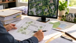
Yes, you can sometimes create a site plan without survey documents for a building permit. Many residential projects can use existing property records, recorded subdivision plats, county GIS information, and owner-provided measurements. However, acceptance depends on the construction project, the accuracy of available information, and your local building department’s requirements.
At Permit For Site Plan, we help homeowners determine whether their existing property information is suitable for professional site plan drafting. Before ordering a new land survey, we recommend understanding what a survey provides, which alternative records may be useful, and when a licensed surveyor is necessary.
Can You Make a Site Plan Without a Survey?
A site plan can sometimes be prepared without hiring a land surveyor, especially when the property boundaries are well documented and the proposed construction is relatively straightforward.
For example, a homeowner planning a small backyard shed may have enough information from an existing plat, previous site plan, and reliable measurements to prepare a drawing acceptable to the local permit office.
However, a new site plan does not automatically establish legal property boundaries. We recommend confirming the municipality’s requirements before choosing a drafting method.
Our Site Plan for Permit service service helps property owners prepare scaled drawings using suitable available information when a new survey is not required.
What Does a Property Survey Provide?
A property survey is prepared by a licensed land surveyor to identify measured property boundaries and other relevant site conditions. Depending on its scope, it may show boundary corners, easements, structures, elevations, and improvements.
A site plan serves a different purpose. It illustrates how existing and proposed construction fits within the property, including building footprints, driveways, setbacks, and access areas.
Site Plan vs. Property Survey
The main difference is professional verification. A survey provides boundary information established through surveying procedures, while a drafted site plan may rely on existing records and supplied measurements. We recommend understanding this distinction before ordering a Plot Plan for Permit, particularly when construction is close to property lines.
Important: A drafted site plan is not a legal boundary survey unless prepared or certified by the appropriately licensed professional under applicable law.
What Can You Use to Create a Site Plan Without a Survey?
Several types of existing property information may support site plan preparation. The best source depends on its reliability, age, completeness, and the reviewing authority’s requirements. We commonly recommend checking the following documents:
- Recorded subdivision plats: May provide lot dimensions, parcel configuration, and recorded boundary information.
- Existing surveys: Can supply previously measured property boundaries when still relevant and reliable.
- County GIS records: Help identify approximate parcel locations, surrounding roads, and existing structures.
- Previous permit drawings: May show approved building footprints, driveways, and historical setbacks.
- Owner measurements and photographs: Help document visible improvements and proposed construction.
These sources can be combined when appropriate, but conflicting information must be resolved rather than assumed correct. If you are unsure where to find property documents, our guide on how to get a site plan of your property explains additional record-retrieval options.
Can You Use County GIS Maps Instead of a Survey?
County Geographic Information System (GIS) maps are useful starting points for understanding a property’s general layout. They often display aerial imagery, parcel outlines, roads, and assessment information. However, GIS maps are not automatically suitable for determining exact legal boundaries. Parcel lines may be approximate, and aerial imagery can contain positioning differences.
Why GIS Parcel Lines May Be Inaccurate
GIS mapping combines information from different sources, including recorded plats, surveys, and geographic databases. The displayed parcel outline may not precisely match physical boundary markers. This becomes particularly important when a proposed fence, garage, or addition is close to a setback line. We recommend using GIS information for preliminary planning rather than treating it as a certified survey.
If you need help locating historical government records, our article on getting a site plan from your county or city explains where to search.
Can You Use an Old Survey or Recorded Plat?
Yes, an existing survey or recorded subdivision plat may provide valuable information for preparing a new site plan.
An older survey may identify boundary dimensions, easements, and building locations. However, its usefulness depends on whether property conditions have changed and whether the permit office accepts it.
When an Existing Survey May Not Be Enough
If the property has undergone boundary adjustments, subdivision changes, or major construction, an older survey may no longer represent current conditions. We recommend comparing available records with the existing property layout before drafting.
For homeowners planning decks, garages, pools, or additions, our Residential Site Plan service can help organize suitable property information into a project-specific drawing.
Can Owner Measurements and Photos Replace a Survey?
Owner-provided measurements and photographs can help document existing structures and proposed improvements, but they do not independently establish legal property boundaries. For example, a homeowner may measure the dimensions of a proposed deck, identify its location relative to the house, and photograph the surrounding yard.
These details can help us understand the project scope and prepare an accurate layout when reliable boundary information is already available.
How to Provide Useful Property Measurements
We recommend measuring existing structures carefully and identifying the proposed construction area. Photographs should show the relevant portion of the property, nearby structures, driveways, and visible obstacles. If measurements conflict with recorded information, additional verification may be required. We never recommend assuming that a fence or landscaping edge represents the legal property line.
Which Projects May Accept a Site Plan Without a Survey?
Some jurisdictions allow homeowners to submit site plans based on existing records for straightforward residential improvements. Projects that may qualify include:
- Decks and patios: When reliable setback and property information is available.
- Sheds and accessory structures: When the location and required clearances can be documented.
- Fences: When boundaries are sufficiently established and local rules do not require a survey.
- Driveway improvements: When existing access and proposed changes can be shown accurately.
Larger garages, additions, and accessory dwelling units may require more detailed information, depending on the jurisdiction. For applications involving multiple drawings, our Building Permit Site Plan service can help identify the site information needed for review.
When Is a Licensed Land Surveyor Required?
A licensed surveyor may be necessary when the municipality explicitly requires a certified survey or when reliable boundary information is unavailable. Boundary disputes, property subdivisions, uncertain easements, and construction near setback limits can also make professional surveying essential. Projects involving complex terrain, floodplain requirements, or significant land development may require additional surveying or engineering information.
We recommend contacting the building department before paying for professional services. The reviewing authority determines whether a survey, site plan, or both are required.
Does a PE Stamp Replace a Property Survey?
No. A professional engineer’s stamp and a licensed land surveyor’s certification serve different professional purposes. Certain construction projects require engineering review, but an engineer’s seal does not automatically replace a boundary survey required by local regulations.
Our PE Stamp Services can help property owners explore engineering review where applicable, without treating that service as a substitute for required surveying.
How to Prepare a Site Plan Without a New Survey
Once the building department confirms that a new survey is unnecessary, the next step is collecting reliable information and preparing a scaled drawing. A typical site plan may need to show:
- Property boundaries, lot dimensions, drawing scale, and north arrow.
- Existing buildings, driveways, and other relevant improvements.
- Proposed construction dimensions and placement.
- Required setbacks and distances from property lines.
- Easements, utilities, or drainage features when requested.
The drawing should clearly distinguish existing conditions from proposed work. Missing dimensions or uncertain boundaries can lead to permit corrections. If the reviewing department requests changes after submission, our Permit Correction and Plan Revision service may help address drawing-related comments.
What Should You Send for a Site Plan Scope Review?
Before ordering a new survey or drafting service, we recommend gathering whatever reliable property information you already have. Start with your property address and a short description of the proposed project. Include an existing survey, subdivision plat, old site plan, county parcel information, photographs, or a simple sketch if available. We can review these materials to help identify what information may be usable for drafting and what additional documentation may be needed.
If your municipality has provided a permit checklist or correction notice, include it as well. This allows us to evaluate the drawing scope against the stated requirements rather than making assumptions.
Get a Site Plan Without Ordering an Unnecessary Survey
A site plan without survey documents may be possible when reliable property records are available and the local building department does not require licensed surveying.
At Permit For Site Plan, we help homeowners understand their options before investing in additional drawings. Our goal is to identify the information needed for the project and avoid unnecessary steps while respecting local permit requirements.
Send us your property address, existing survey or plat, photographs, sketch, and project details for a free scope review. Visit our Get a Custom Quote page to discuss your site plan requirements and the next steps.
Frequently Asked Questions
Can I Draw My Own Site Plan Without a Survey?
Some jurisdictions accept homeowner-prepared site plans when they are accurately scaled and contain the required information. Others require professional drawings or certified property measurements.
Is a Site Plan the Same as a Boundary Survey?
No. A site plan illustrates property improvements and proposed construction. A boundary survey establishes measured boundary information through a licensed surveyor.
Can Google Earth Be Used to Make a Site Plan?
Google Earth can help visualize existing buildings and property features, but its imagery does not establish legal boundaries or guarantee accurate setback measurements.
Do I Need a Survey for a Fence Permit?
Not always. Requirements depend on local regulations, boundary certainty, and the fence location. A survey may be necessary when the boundary is unclear.
Can I Use an Old Survey for a New Permit?
Possibly. An existing survey may be suitable if its information remains relevant and the reviewing authority accepts it. Changed conditions may require updated measurements.
Will a City Accept a Site Plan Without a Survey?
Some cities accept plans prepared from reliable existing records. Others require certified surveys for particular projects. Always check the local permit checklist.
Can a Professional Drafting Service Replace a Surveyor?
A drafting service can prepare site plans using suitable information, but it cannot replace licensed boundary surveying when surveying is legally required.
What Happens if My Site Plan Is Rejected?
Review the correction notice to identify whether the issue concerns missing drawing details, inaccurate measurements, or a required survey. The appropriate correction depends on the stated deficiency.