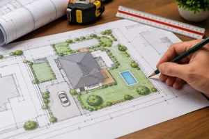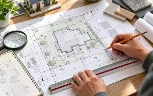
A site plan for a building permit must be accurate enough to clearly show property boundaries, building locations, proposed construction, and setback distances. If you are wondering how accurate does a site plan need to be, the answer depends on your project, local building department requirements, and whether verified property measurements are necessary.
Not every residential project requires a professional boundary survey, but measurements should never be guessed when they affect zoning compliance. At Permit For Site Plan, we help property owners understand drawing accuracy requirements and prepare clear site plans that support the permit review process.
How Accurate Does a Site Plan Need to Be for Permit Approval?
A permit site plan should accurately represent your property’s existing conditions and proposed improvements using reliable measurements and a consistent drawing scale. The building department must be able to understand where construction will occur and whether it meets applicable requirements.
For straightforward residential projects, a scaled drawing based on dependable property records and measurements may be sufficient. However, construction near property boundaries, major additions, and complex developments may require more precise information or a licensed survey.
Our site plan for permit service helps property owners prepare scaled drawings based on their project information and the relevant submission requirements.
The important distinction is that there is no universal measurement tolerance accepted by every US building department. Even a small error can affect permit approval when a proposed structure is close to a required setback.
Understanding Site Plan Accuracy, Precision, and Legal Boundary Certainty
Although these terms are sometimes used interchangeably, they describe different aspects of a site plan.
Accuracy means the drawing correctly represents actual property conditions. Precision refers to the level of measurement detail shown, while legal boundary certainty concerns whether property lines have been reliably established through appropriate survey information.
For example, a drawing might show a proposed garage exactly 10 feet from a property line. However, if that property line was estimated from satellite imagery, the measurement may appear precise without being reliable.
I recommend understanding where your measurements come from before using them in permit documents. Our building permit site plan service supports projects where clear property layouts and proposed construction details are necessary for review.
Why Drawing Scale Matters for Site Plan Accuracy
A site plan must use a consistent scale so reviewers can understand the relationship between property dimensions and proposed construction. Common drawing scales include 1 inch representing 10 feet, 20 feet, or another distance appropriate for the property’s size. The correct scale depends on the project and the reviewing department’s specifications.
An inaccurate or inconsistent scale can make structures appear closer together or farther apart than they actually are. Even when written dimensions are correct, an improperly scaled drawing may create confusion during review.
We recommend checking the drawing scale before submission. Our site plan scale calculator can help you understand the relationship between measurements shown on a plan and their real-world dimensions.
Property Lines and Lot Dimensions Must Be Reliable
Property boundaries form the foundation of an accurate site plan. They establish the lot’s shape and size and provide reference points for setbacks, building locations, and other site improvements. I recommend using an existing boundary survey, recorded plat, or reliable property document whenever available. County GIS maps and assessor records can also provide useful preliminary information, but they may not establish legal boundaries with survey-grade certainty.
This distinction becomes especially important when proposed construction approaches a property line.
Our guide explaining site plans versus property surveys can help you understand when an ordinary drafted plan may be appropriate and when professional boundary verification becomes necessary.
Why Setback Measurements Require Greater Accuracy
Setbacks are among the most important measurements on a permit site plan because they show the distance between proposed improvements and property boundaries. A small measurement error may create a major problem if construction is close to the minimum permitted setback. For example, if a garage must remain 5 feet from a property line, showing a 5-foot setback without reliable measurements creates a risk that the actual structure could violate zoning requirements. When reviewing setback information, I recommend confirming:
- The applicable front, side, and rear setback requirements.
- The distances between proposed structures and property boundaries.
- Whether easements, zoning rules, or building projections affect the permitted construction area.
Our guide on how to measure permit setback requirements explains the measurements homeowners should understand before planning construction.
Accurate Existing and Proposed Structure Dimensions
A permit-ready site plan should clearly distinguish existing buildings from proposed improvements. This helps reviewers understand what is already on the property and how the new construction will change its layout.
We recommend showing the correct footprints and locations of the house, garage, driveway, accessory buildings, and other relevant improvements. Proposed construction should be identified separately, with dimensions and distances that match the project information. These measurements may also affect zoning calculations. Our lot coverage calculation guide explains how building footprints relate to the percentage of a property occupied by structures.
If your project adds driveways, patios, or other paved areas, the impervious surface calculator can help estimate surface coverage using the measurements you provide.
When Can Public Property Records Be Accurate Enough?
Public property records can sometimes provide enough information to begin preparing a basic residential site plan, particularly when the proposed work is straightforward and does not depend on uncertain boundary locations.
County parcel maps, GIS databases, and available aerial imagery may help identify lot shapes, existing structures, and general property layouts.

However, I do not recommend treating these resources as guaranteed evidence of exact legal boundaries. Their accuracy depends on the underlying data and how frequently it has been updated.
For projects requiring greater certainty, we recommend verifying measurements through existing surveys, field measurements, or qualified professionals before finalizing the drawings.
When Is a Field Measurement or Professional Survey Necessary?
Some projects require more accurate information than public records or homeowner estimates can provide. We recommend considering additional measurement or surveying when:
- Construction is close to a property boundary or required setback.
- Property corners, dimensions, or boundary locations are uncertain.
- The project involves significant grading, drainage changes, or flood-related restrictions.
- The building department specifically requires certified survey information.
- Existing records conflict with actual site conditions.
For simpler improvements, a professionally drafted residential site plan may meet the department’s requirements without a new survey. However, a drafting service cannot replace a licensed surveyor when legal boundary verification is required.
Common Site Plan Accuracy Problems That Cause Permit Rejections
Many site plan corrections result from missing dimensions, inconsistent measurements, unclear property boundaries, or incomplete drawing information. For example, a drawing may show a new shed without indicating its distance from the rear property line. Another plan might show a driveway extension but omit the resulting impervious surface area. Inconsistent dimensions between different drawing sheets can also create questions during permit review.
At Permit For Site Plan, we recommend reviewing these details before submission because addressing them early can reduce avoidable correction requests.
If your building department has already identified drawing problems, our permit correction and plan revision service can help address the requested changes.
How to Verify Site Plan Accuracy Before Submission
Before submitting your site plan, I recommend checking both the measurements and the supporting information used to prepare the drawing. Start by comparing the property boundaries and dimensions with available surveys or reliable records. Confirm that the existing structures reflect current site conditions and that proposed improvements match your intended construction.
Then review the setbacks, scale, north arrow, easements, and any calculations required by your jurisdiction. Make sure measurements remain consistent across all drawing sheets and supporting documents.
You can also use our site plan checker as an additional review resource. However, it should not replace official building department review or professional verification where required.
Get an Accurate Site Plan for Your Building Permit
Understanding how accurate a site plan needs to be helps you make better decisions before submitting a permit application. Reliable property dimensions, clear setbacks, consistent scales, and accurate structure locations all contribute to a drawing that reviewers can evaluate confidently.
At Permit For Site Plan, we help homeowners and contractors prepare site drawings based on their project requirements and available property information. If you are unsure whether your existing documents are accurate enough, we can help identify what additional information may be needed.
Ready to prepare your permit site plan? Request a custom quote and send us your property documents, project details, and any city checklist or reviewer comments. We will review your request and help determine the appropriate next step.
Frequently Asked Questions
Is a site plan allowed to be off by 1 or 2 feet?
There is no universal 1–2-foot tolerance for US permit site plans. Some projects may allow approximate information, but setback compliance and property boundary measurements can require much greater accuracy. Always follow your local building department’s requirements.
Does a permit site plan have to be professionally surveyed?
Not always. Many straightforward residential projects can use a scaled site plan without a new survey. However, certain jurisdictions or projects require certified boundary information or professionally prepared documents.
Can satellite imagery provide accurate site plan measurements?
Satellite imagery can help identify structures and general property layouts. However, it should not be relied upon alone for exact property boundaries or setback measurements.
What is the best scale for a residential site plan?
Common scales include 1 inch equals 10 feet or 20 feet. The appropriate scale depends on property size, drawing readability, and local submission requirements.
Can an inaccurate site plan cause a permit rejection?
Yes. Incorrect setbacks, missing dimensions, unclear property lines, or inconsistent building locations can result in correction requests or permit rejection. Clear and reliable measurements help reduce these problems.
How accurate should a site plan be for a fence or shed?
The drawing should accurately show the proposed location, relevant dimensions, and required setbacks. If construction is close to a boundary, verified measurements may be necessary even for a relatively small structure.
Do I need exact lot coverage calculations?
If the reviewing authority requires lot coverage information, calculations should use dependable building footprint and property area measurements. Incorrect figures may affect zoning compliance.